Nature of the Amami
Amami Oshima, Kikaijima, Tokunoshima, Okinoerabujima, Yoronjima
Amami Oshima Island
It was picked up on the other website!
Rich in Forest, Mangrove, Rivers, and Endemic Species
Located at the northern tip of Amami Islands, with 460km (285.8 miles) in circumference, covering an area of 720㎢ (278 mile2), Amami Oshima island is the second largest island after Sado Island. The island can be roughly divided into three areas: the northern area with numerous gentle and beautiful beaches, the central area with mangroves and a big river, and the southern area, bordered with a deep ria shoreline, forming a wide marine region composed of other smaller inhabited islands such as Kakeromajima, Ukejima, and Yorojima, as well as numerous uninhabited islands. Mt. Yuwan (694m or 2277 ft) is the highest mountain in the group of islands. World’s uncommon indigenous species such as Amami rabbit (Pentalagus furnessi) and Lidth’s jay (Garrulus lidthi), and rare fauna and flora are found in the island. Venomous snakes, habu (Protobothrops flavoviridis) reigns at the top of the island’s ecosystem.
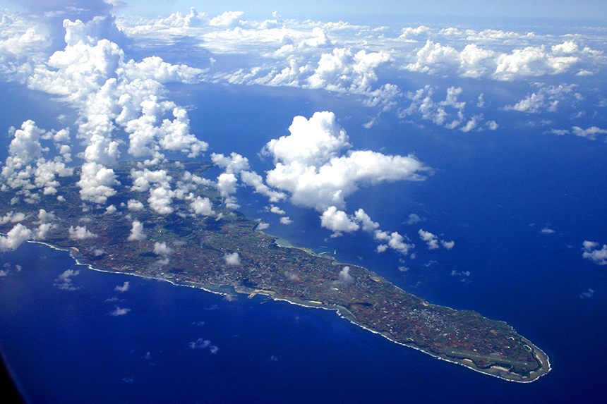
Oshima Strait in south Amami Oshima island
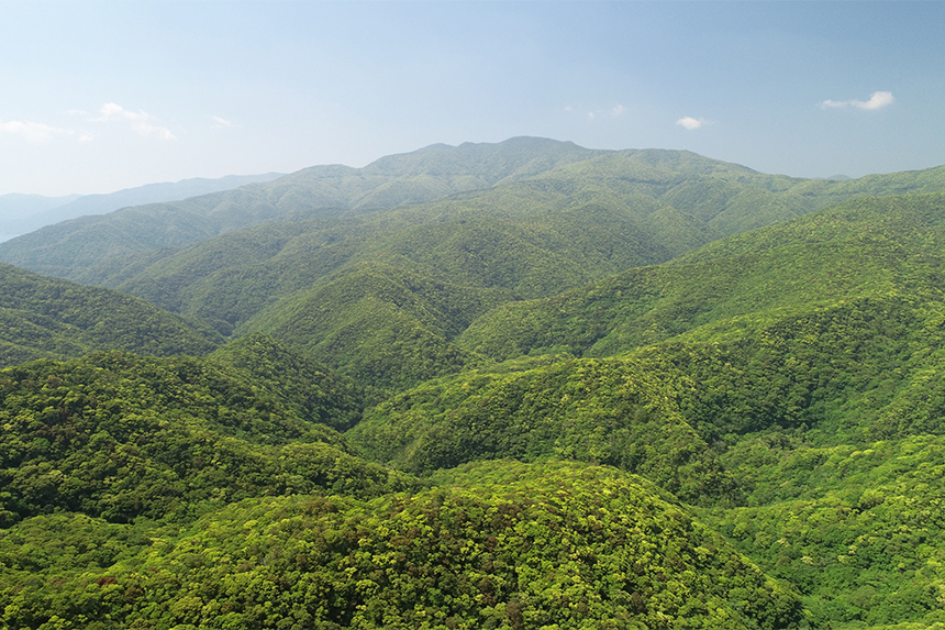
Mt. Yuwan, the highest mountain in the Amami archipelago
At the mouth of the river in the central area of the island, there spreads the second largest mangrove forest (71ha or 0.27 mile2) in Japan, next to that in Okinawa’s Iriomotejima island. This brackish water region has nurtured more than 300 species. The mangrove forest consists of Ohirugi (Bruguiera gymnorhiza) and Mehirugi (Kandelia obovate) trees. The former represents the northern limit of its natural inhabitation and the latter the northern limit of its colonial inhabitation). The forest supports a rich ecosystem consisting of Ryukyu Ayu (sweet fish: Plecoglossus altivelis ryukyuensis), endemic subspecies branched from its parent species approx. a million years ago, and other fish as well as a variety of wild birds.
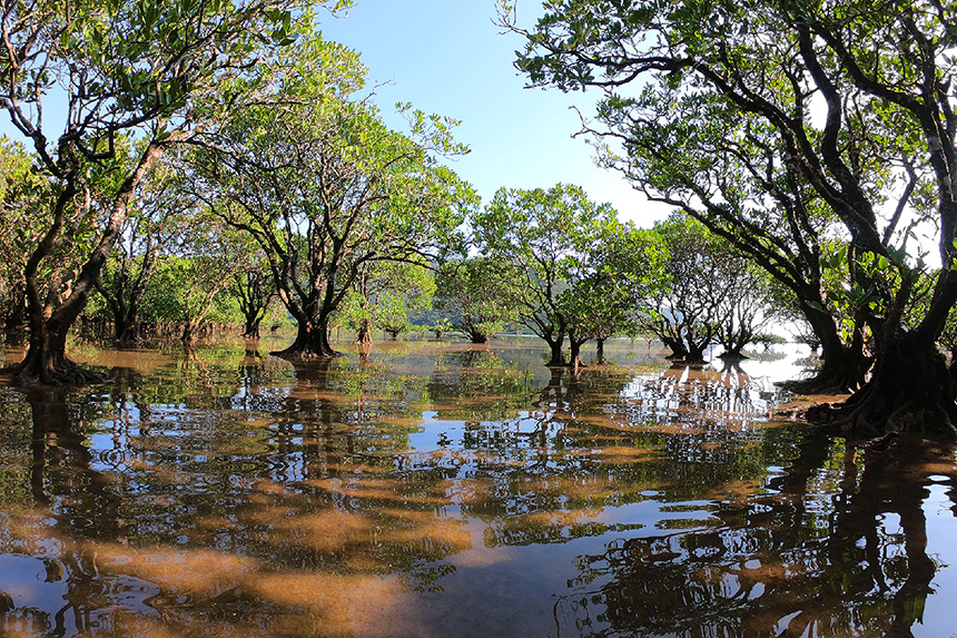
Mangrove forest in central Amami Oshima island
Nature of Kikaijima Island
The World’s Second Fastest Annual Uplift Rate
Kikaijima, located at 25km (15.5 miles) east from Amami Oshima island, is an island with a circumference of 50 km (31 miles) and area of 57 km2 (22 mi2).
As the island does not have a river, an underground dam was built to achieve stable supply of water throughout the island. The dam also serves as the main source of agricultural water, supplied via sprinklers located all over the island.
Hyakunodai, the highest area (203 m or 666 ft) in Kikaijima island
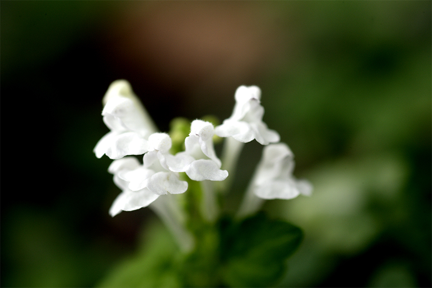
Hinatatsuminasou (Scutellaria kikai-insularis Hatus. ex T.Yamaz.), an endemic species in Kikaijima
Nature of Tokunoshima
It was picked up on the other website!
UNESCO World Natural Heritage Site with Amami Oshima
The ancient northern part and the broad space in the south
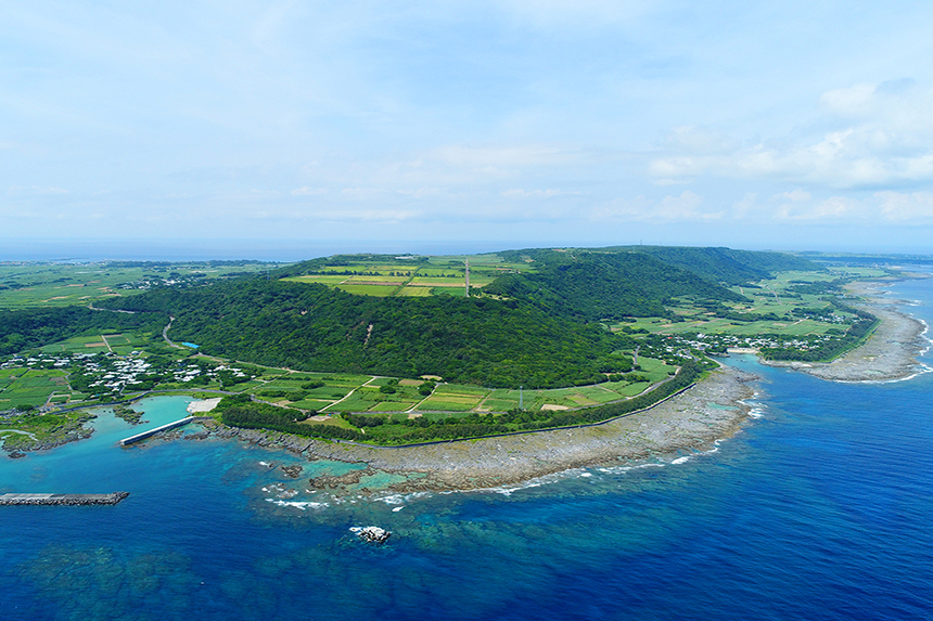
Second in size to Amami Oshima Island (approx. 84km (52.19 miles) around and approximately 248km2 (95.75 miles2)) and with old strata and granite as its skeleton, Tokunoshima Island also features mountains of 400-600m (437.44 – 656.16 yard) in height in the north-central part of the island. The western and southern parts of the island are covered with newly elevated coral reefs. The Amami Rabbit (Pentalagus furnessi) and Habu (Protobothrops flavoviridis) Pit Viper live here in addition to Amami Oshima. Tokunoshima Island is home to the Tokudaia tokunoshimensis,
Goniurosaurus splendens, Asarum simile, and other unique flora and fauna and became a World Natural Heritage site along with Amami Oshima.
Mt. Inogawa, highest peak on Tokunoshima (645m (appx. 705 yard))
Granite coastline of Cape Mushiro looks like a straw mat
Okinoerabujima
Limestone cave and karst geographical feature
Okinoerabujima island is a flat island with approximately 56km (34.8 miles) in circumference, covering an area of approximately 94㎢ (36.3 mile2). Its back‐arc basin is an old stratum called Shimanto group, over which elevated coral reefs widely cover to form the entire island. Its unique geographical features include karst landforms and sinkholes (aka dolines) formed through the process that these reefs dissolves into water.
There exist 200 – 300 limestone caves, with both big and small ones combined, in the island. As the island has only one river, and underground water and spring water have been used as a community water supply. Now more stable harvest of produce is expected, thanks to the stable water supply enabled by a new underground dam. No habu venomous snakes inhabit the island.
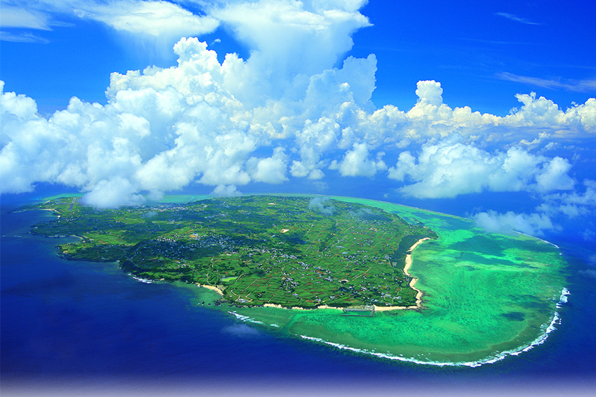
Flat Okinoerabujima island viewed from the sky
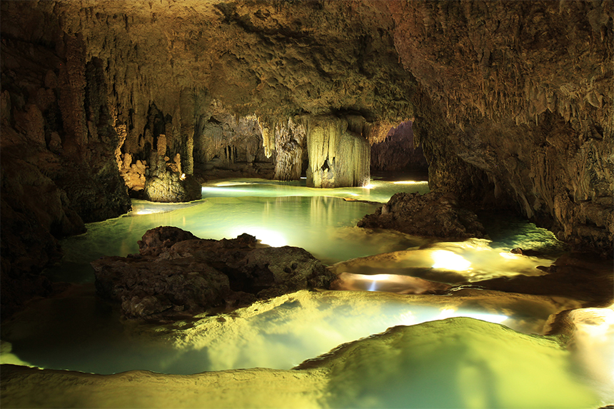
Ōyama Suikyodo, the second longest limestone cave in Japan (total extension)
Yoron Island
A Solitary Pearl Afloat in the East
The southernmost point of the Amami archipelago, Yoron Island is located approximately 23km (14.29 miles) from Okinawa’s main island and marks the southernmost tip of Kagoshima Prefecture. It is approximately 24km (14.91 miles) around, with an area of approximately 21km2 (8.10 miles2). It’s a flat island that is 97m (106.08 yard) at its highest altitude. The cytoskeleton of the island is made up of older strata, but an elevated coral reef covers these ridges and surrounds the island perimeter in a hem reef. The beautiful white sand of Yurigahama beach is especially famous because the beach only comes out at low tide. The island is described as a “pearl floating in the East”. It’s also the northernmost island in Japan where you can see the Southern Cross.
Yoronjima from the air
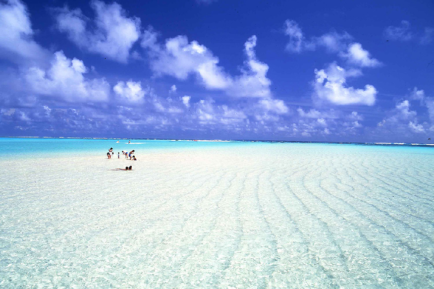
Yurigahama Beach appears only at low tide
Photos / Futoshi Hamada
Captions / HORIZON Editorial Office